


DELPHI — The legal team for accused Delphi murder suspect Richard Allen is asking the public for help in paying for the cost of defense experts in Allen’s upcoming jury trial.

(Family Features) A walk is not just good for your body, it’s also good for your soul. Physical activity, like walking, is one of the best ways to reduce stress and boost your mood. However, reports show walking rates are declining steadily in the United States.
STATEHOUSE (April 12, 2024) – Greater Lafayette will receive $35 million as part of a state-led effort to support local quality of place and quality of life initiatives, according to State Rep. Sharon Negele (R-Attica) in a news release.

DANVILLE — A Georgetown man was sentenced Wednesday to nine years in prison for driving drunk and causing a car crash that killed three people in 2022.
Weekly Smiles

Mary Emmrich is smiling because she crossed from the North American to the Eurasian tectonic plate Thingvellir National Park, Iceland.


Kentland, IN
Right Now
45°
Cloudy
- Humidity: 97%
- Feels Like: 39°
- Heat Index: 45°
- Wind: 13 mph
- Wind Chill: 39°
- UV Index: 0 Low
- Sunrise: 06:05:37 AM
- Sunset: 07:32:51 PM
- Dew Point: 45°
- Visibility: 9 mi
Today
Cloudy. Low 43F. Winds NNW at 10 to 20 mph.
Tonight
Cloudy. Low 43F. Winds NNW at 10 to 20 mph.
Tomorrow
Sunshine in the morning followed by cloudy skies during the afternoon. High around 55F. Winds NW at 10 to 20 mph.
Day
Temp
Thu
Thu
Thursday
69°/43°
Mostly cloudy. Lows overnight in the low 40s.
Chance of Rain: 11%
Sunrise: 06:05:37 AM
Sunset: 07:32:51 PM
Humidity: 93%
Wind: NNW @ 15 mph
UV Index: 0 Low
Thursday Night
Cloudy. Low 43F. Winds NNW at 10 to 20 mph.
Fri
Fri
Friday
55°/36°
Mix of sun and clouds. Highs in the mid 50s and lows in the mid 30s.
Chance of Rain: 1%
Sunrise: 06:04:07 AM
Sunset: 07:33:55 PM
Humidity: 51%
Wind: NW @ 16 mph
UV Index: 7 High
Friday Night
Partly cloudy skies. Low 36F. Winds WNW at 10 to 15 mph.
Sat
Sat
Saturday
52°/34°
Mostly sunny. Highs in the low 50s and lows in the mid 30s.
Chance of Rain: 1%
Sunrise: 06:02:38 AM
Sunset: 07:34:58 PM
Humidity: 46%
Wind: WNW @ 16 mph
UV Index: 7 High
Saturday Night
A few clouds. Low 34F. Winds WNW at 5 to 10 mph.
Sun
Sun
Sunday
59°/38°
Abundant sunshine. Highs in the upper 50s and lows in the upper 30s.
Chance of Rain: 3%
Sunrise: 06:01:10 AM
Sunset: 07:36:02 PM
Humidity: 43%
Wind: WNW @ 11 mph
UV Index: 7 High
Sunday Night
A mostly clear sky. Low 38F. Winds W at 5 to 10 mph.
Mon
Mon
Monday
65°/49°
A few clouds. Highs in the mid 60s and lows in the upper 40s.
Chance of Rain: 3%
Sunrise: 05:59:43 AM
Sunset: 07:37:05 PM
Humidity: 41%
Wind: SW @ 12 mph
UV Index: 7 High
Monday Night
Cloudy during the evening. A few showers developing late. Low 49F. Winds SSW at 10 to 20 mph. Chance of rain 30%.
Tue
Tue
Tuesday
61°/37°
Showers possible. Highs in the low 60s and lows in the upper 30s.
Chance of Rain: 57%
Sunrise: 05:58:16 AM
Sunset: 07:38:09 PM
Humidity: 59%
Wind: SW @ 19 mph
UV Index: 4 Moderate
Tuesday Night
Partly cloudy. Low 37F. Winds NNW at 10 to 20 mph.
Wed
Wed
Wednesday
57°/34°
Mostly sunny. Highs in the upper 50s and lows in the mid 30s.
Chance of Rain: 4%
Sunrise: 05:56:51 AM
Sunset: 07:39:12 PM
Humidity: 54%
Wind: NNE @ 12 mph
UV Index: 7 High
Wednesday Night
Partly cloudy. Low 34F. Winds NE at 5 to 10 mph.
Recent Obituaries
Follow us on Facebook
Special Sections Spotlight


featured
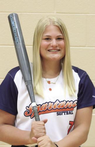
The North Newton Spartan’s added another victory to their record on April 16 after shutting out South Central 2-0.

featured
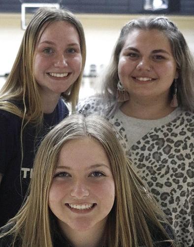
The South Newton Rebels’ softball team recently secured their first victory of the season with an astounding 18-4 victory over Benton Central, marking a significant milestone for the team’s yo…

GARY — North Newton jumped ahead 4-0 after the first inning and cruised to an 11-1 victory in five innings over Rensselaer Central at the Railcat Classic in Gary on Monday night.

featured
RENSSELAER — High school baseball was played at Saint Joseph’s College’s Gil Hodges Field for the first time in seven years when South Newton hosted West Central for a Midwest Conference conte…
Trending Food Videos

The estimated monthly mortgage payment for a median-priced U.S. home is about 54% higher today than it was just two years ago. These are the states and metros who have been most impacted by high interest rates.
This tax season, millions of Americans have sent in payments to a poorly managed organization that spends trillions more than it receives in revenue. Absurdly, its customers will continue receiving a poor product that causes more problems than it solves. If our federal government was run like a business, these results would be unacceptable and the leaders would be fired.

Tornadoes have impacted all U.S. states during the last decade, save for Alaska, causing $14.1 billion in damages. Half of that damage occurred in just five states: Alabama, Arkansas, Illinois, Mississippi, and Texas, demonstrating the pronounced shift eastward from Tornado Alley to “Dixie Alley”—the area roughly stretching from eastern Texas to the western borders of the Carolinas. It also underscores the growing evidence that global warming is making extreme weather events more frequent or more intense. To find the locations seeing the biggest increase in tornadoes, researchers ranked locations by the total change in high-intensity tornado occurrences from the 20-year period ending in November 2004 to the 20-year period ending in November 2023.


